11th September 2012
Today we set off from Wentworth for Mungo National Park which lies mostly within the Willandra Lakes Region World Heritage Area. It is part of an ancient dry lake bed in south west New South Wales.During the last ice age, Lake Mungo was one of a chain of freshwater lakes strung along Willandra Creek. These dry lake beds preserve the longest continual record of aboriginal life in Australia, dating from approximately 40,000 years ago to the present day.
We got up early as we knew we had a full day ahead of us as the Mungo National Park will be approximately a 400 km round trip. I packed some lunch as there aren't any shops to buy food and we aren't sure just what will be available in the park so we will be prepared with our food and drinks.
From the town of Wentworth to the Top Hut Road was a good bitumen road of a distance of about 90 km, and then we entered Top Hut Road which was a good dirt road for about 60 km to the entrance to the Mungo National Park. We are not sure what to expect of the park itself, but the brochures we have seen have made us very interested to explore this area some more.
 |
Top Hut Road to Mungo National Park
|
We arrived at the Interpretive Centre and were surprised to find a really modern building with a lot of information about the park and the aboriginal culture. The Interpretivc Centre had an outdoor area with beautiful native plants and a walkway up to a lookout and several walking tracks clearly marked.There were also shelters for picnics and an undercover bbq area. Just a short walk away was the shearing shed which had been preserved as well as an accommodation block.
 |
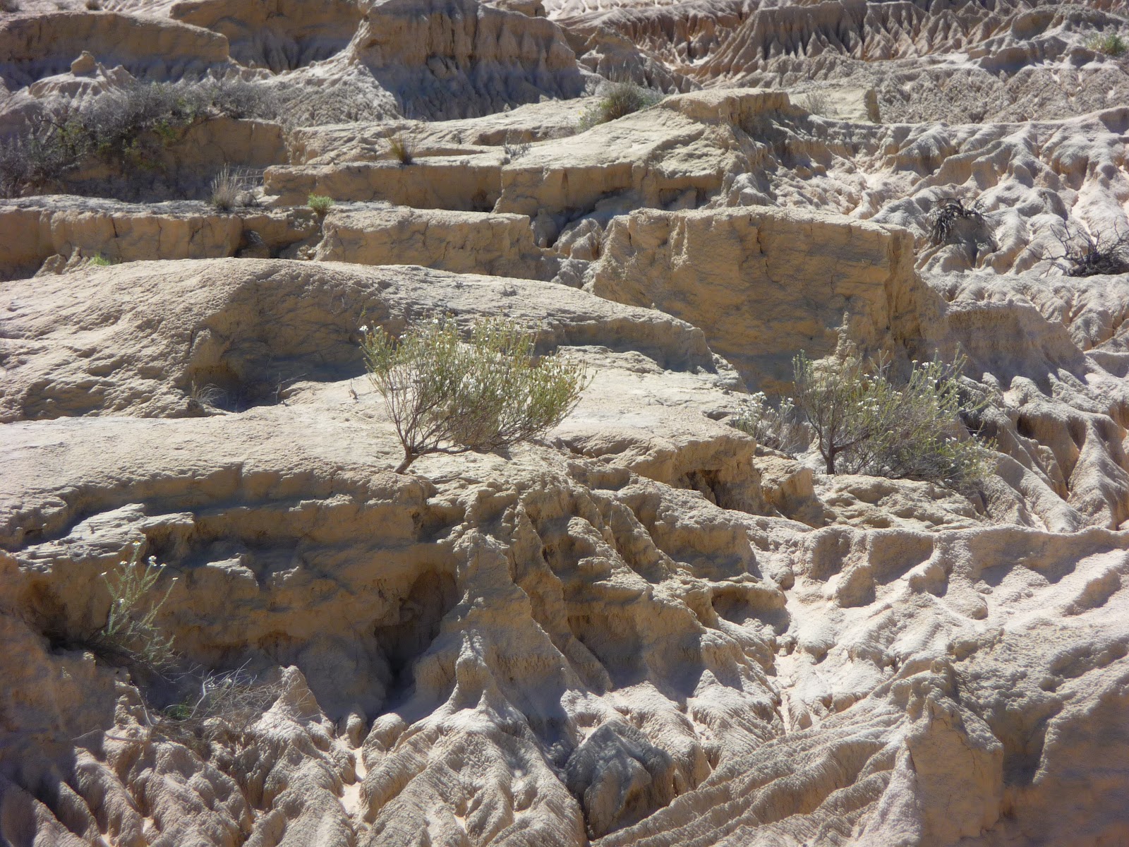
| Walls of China, Mungo National Park |
 |
| Our first view of the Lunette |
 |
These little wildflowers are known as Poached Egg daisies
|
 |
More wildflowers in Mungo NP
|
 |
| View from the Interpretive Centre to the Shearing Shed |
 |
| An emu on the drive to the Walls of China |
 |
| A lizard tries to hide |
We decided to take the self drive tour to the Walls of China and from there we did a short walk on a boardwalk to a viewing area to take the photos of this amazing landscape.
From the first viewing area, we then drove to another viewing area near the Red Top Tank and after parking the car we walked to another viewing area, again with very easy access on a boardwalk.
 |
| The lake or tank known as Red Top Tank |
From here we were able to view the area at close range and it was amazing to see the natural beauty of the area, and to see just how remote this area is.
 |
| More views of the lunette |
 |
| The spectacular lunette (walls) |
We drove back to The Interpretive Centre and had our lunch & walked to the shearing shed.
 |
| Outside The Interpretive Centre |
Back at the Interpretive Centre we had another look around at the various sculptures.
 |
| The sheltered picnic areas at the Interpretive Centre |
The Mungo Woolshed was constructed in 1869 of locally hand cut Cypress Pine, a termite resistant timber.
 |
| The shearing shed timbers |
 |
| Inside the shearing shed |
 |
| A little swallow in the roofing timbers |
 |
| View from inside the shearing shed to the race |
One of our grandaughters made these cut out dolls for us, so we took a photo of them having lunch with us at Mungo. They are all smiling so I think they are enjoying their holiday!
We then set off back down the Top Hut Road and on to Pooncarie, an old port on the Darling River. This town was huge in its hey day, but now there is not much in the town itself, but it was interesting to see where the riverboats would have loaded their supplies on the Darling River.
 |
| An unusual advertisement |
 |
| The Daarling River at Pooncarie |


No comments:
Post a Comment
I really enjoy reading your comments and will reply as soon as possible. Thanks.